Bucket List Roads You Need to Drive - UK Edition
In the search for the ultimate driving road, we often find ourselves drawn to the far corners of the earth. We seek out iconic routes like the legendary Stelvio Pass or the breathtaking Col de Torini. However, amidst this quest, we must remember that "a wise traveller never despises his own country." Indeed, the UK's rolling hills, rugged coastlines, and majestic mountains host some truly exceptional stretches of tarmac, and as Spring approaches, we shouldn't overlook the beauty and charm of our own backyard. So without further ado, here are six bucket list roads you need to go and drive.
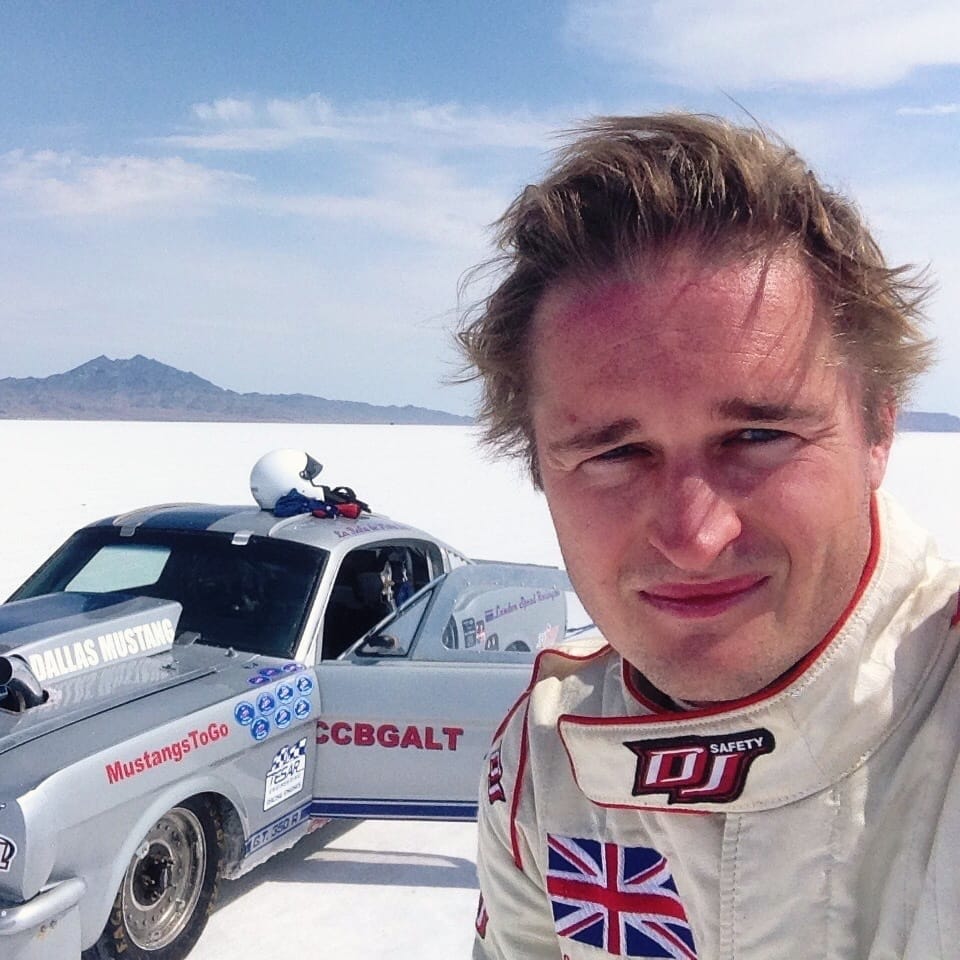
Written by Archie Hill for The Apex by Custodian.
Buttertubs Pass, Yorkshire Dales
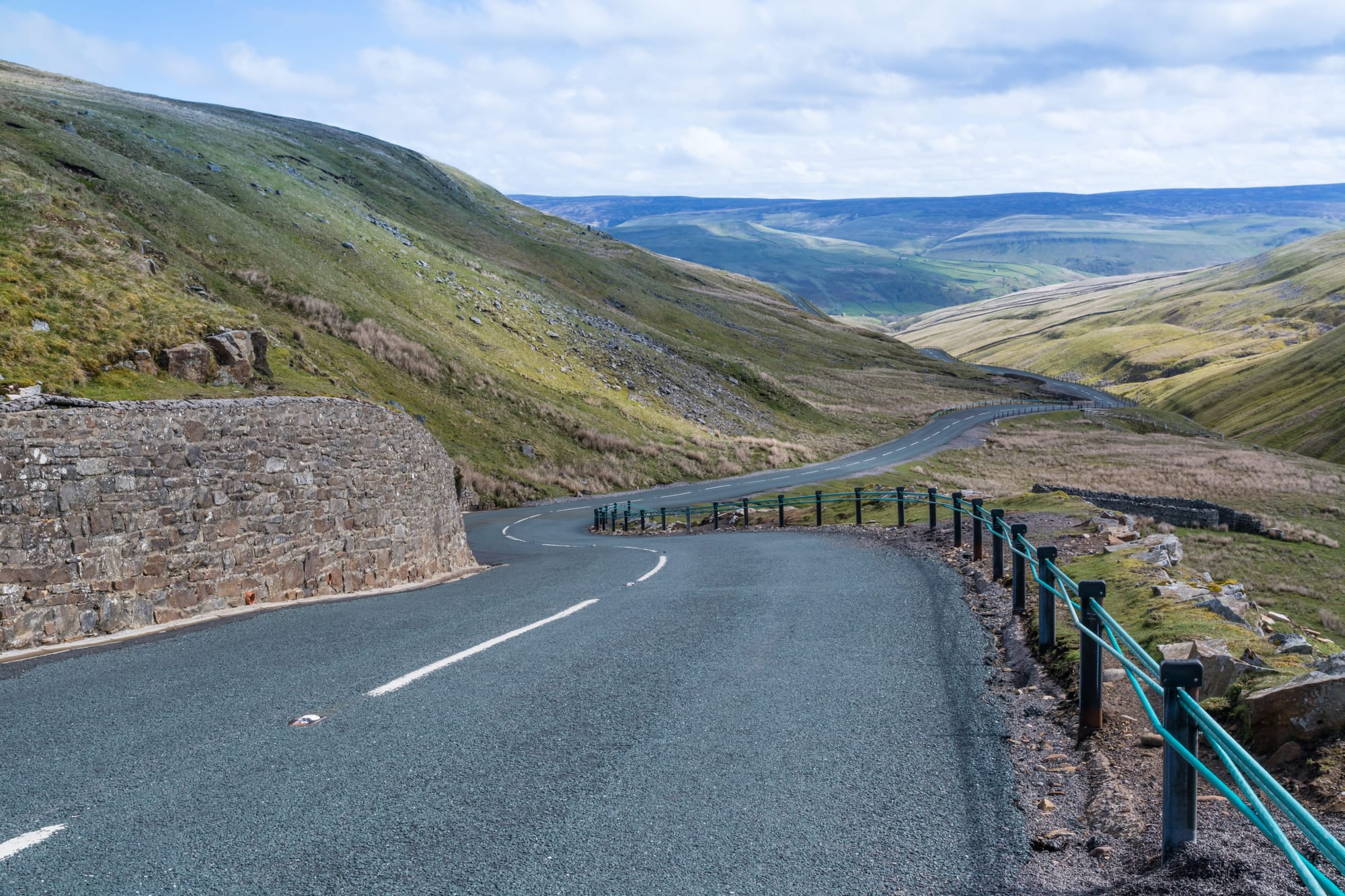

First up, God's Own Country (or County...). Either way, I refer of course to Yorkshire, and in particular to Buttertubs Pass. Described by Jeremy Clarkson as “England’s only truly spectacular road”, Buttertubs Pass connects the small market town of Hawes to the hamlet of Thwaite, in a remote part of the Yorkshire Dales. It's a 6 mile long mountain pass with a steep climb, several sharp bends and a drop of over 400 feet along its length.
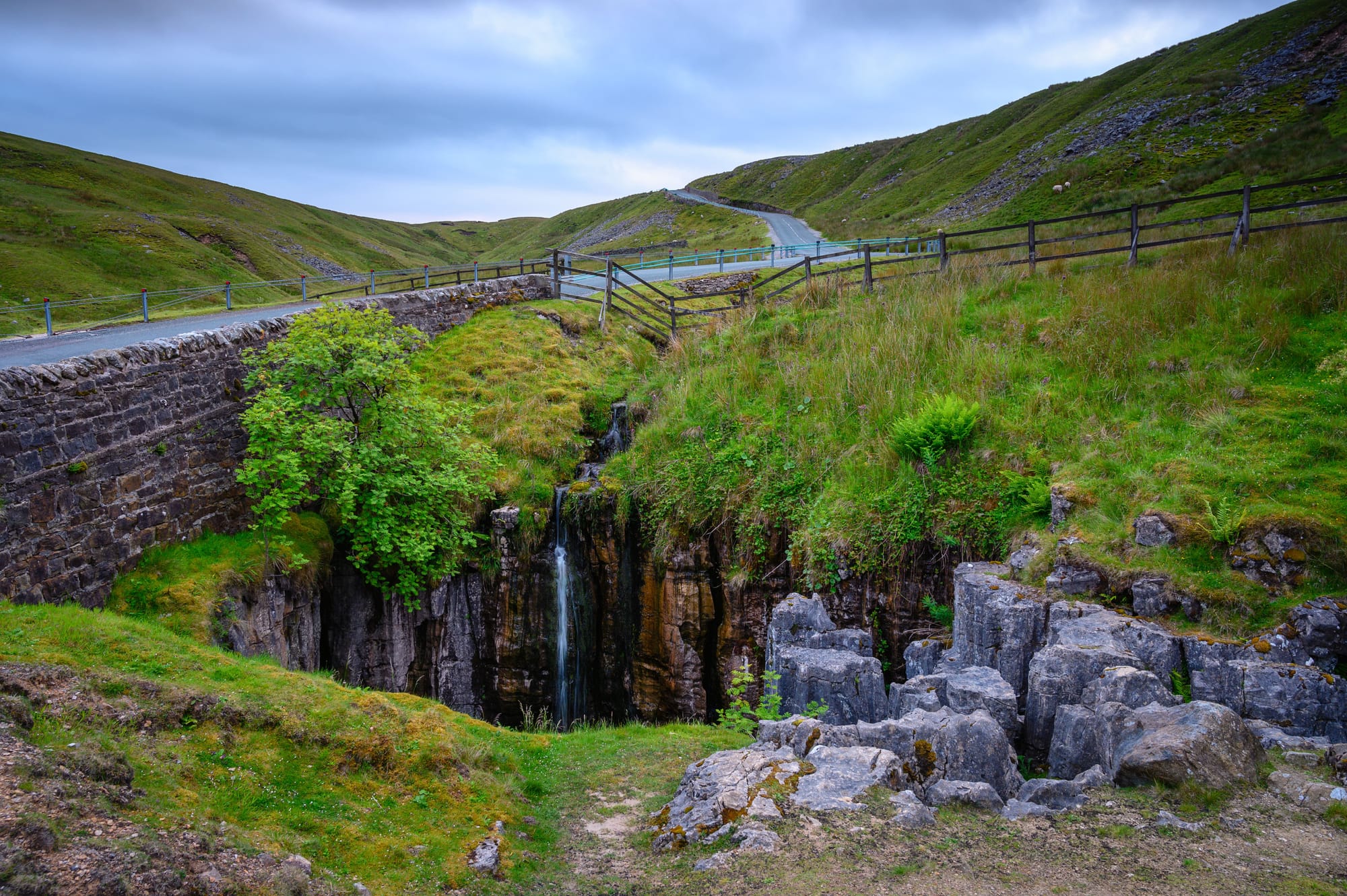
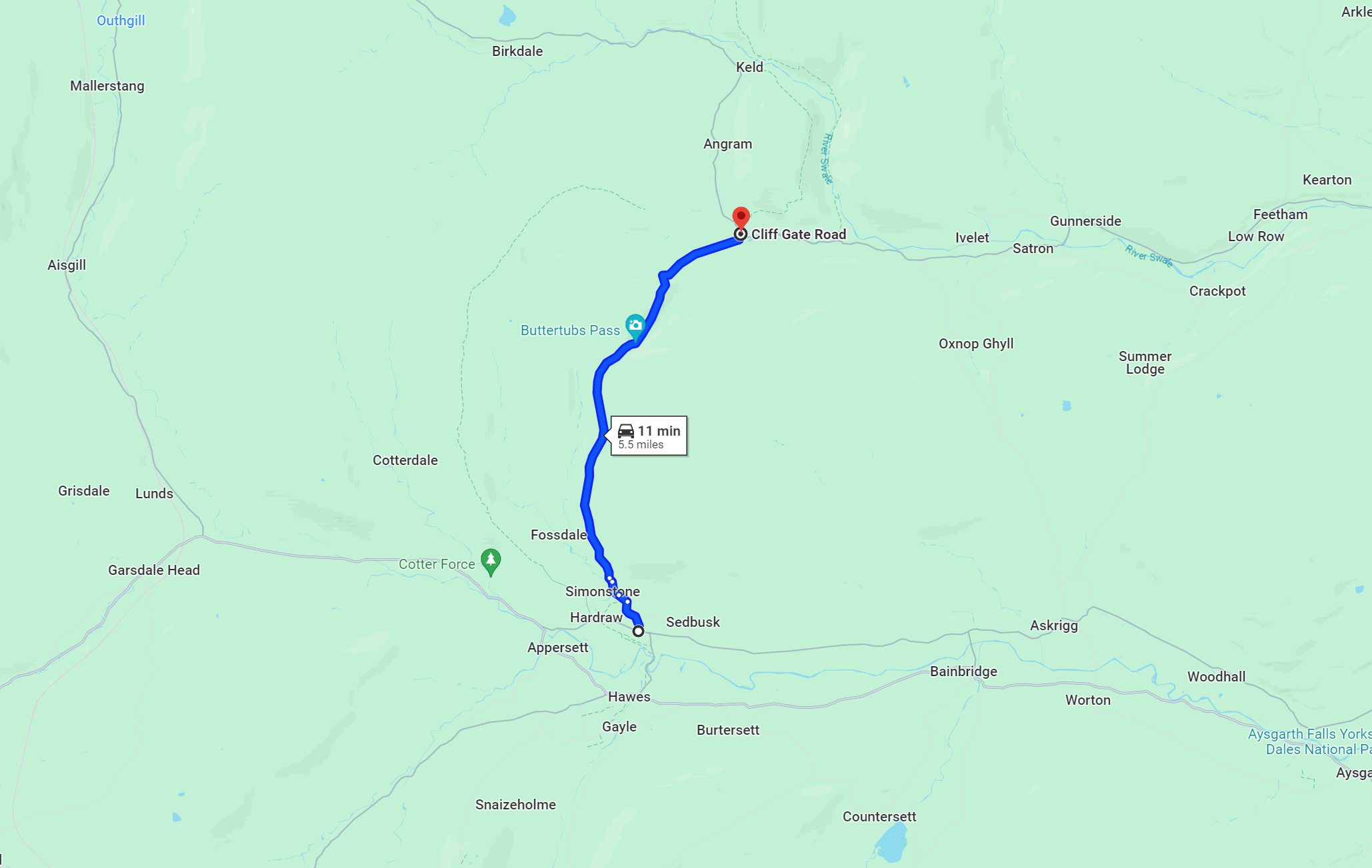
There are also many connecting roads that are worth exploring. You are, after all, in one of England’s finest national parks. The name ‘Buttertubs’ refers to the 20 metre deep limestone potholes that farmers would use to lower their Butter into to keep it cool while en route to market. Rest assured these potholes won’t interfere with your driving experience.
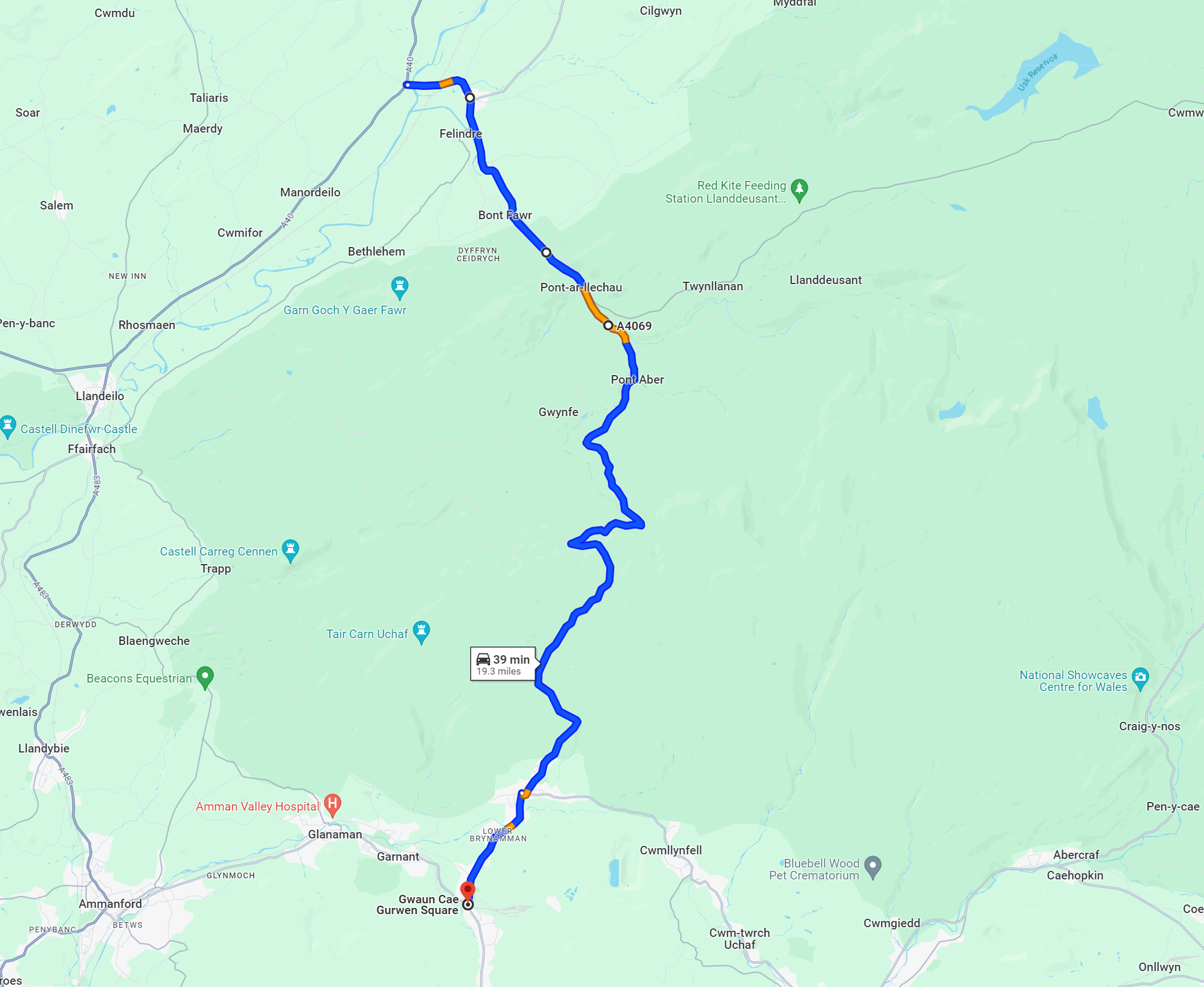
Black Mountain Pass, South Wales
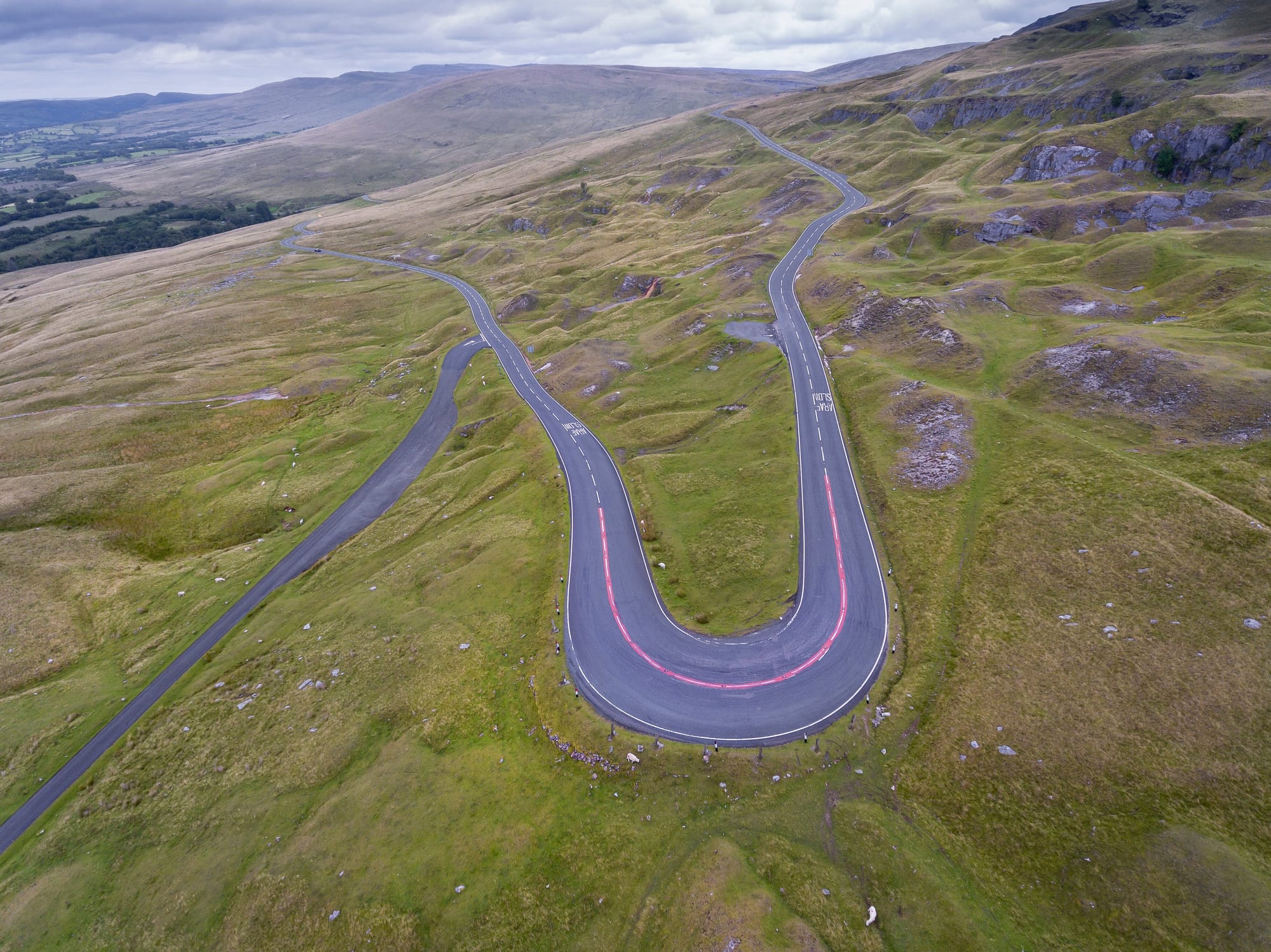

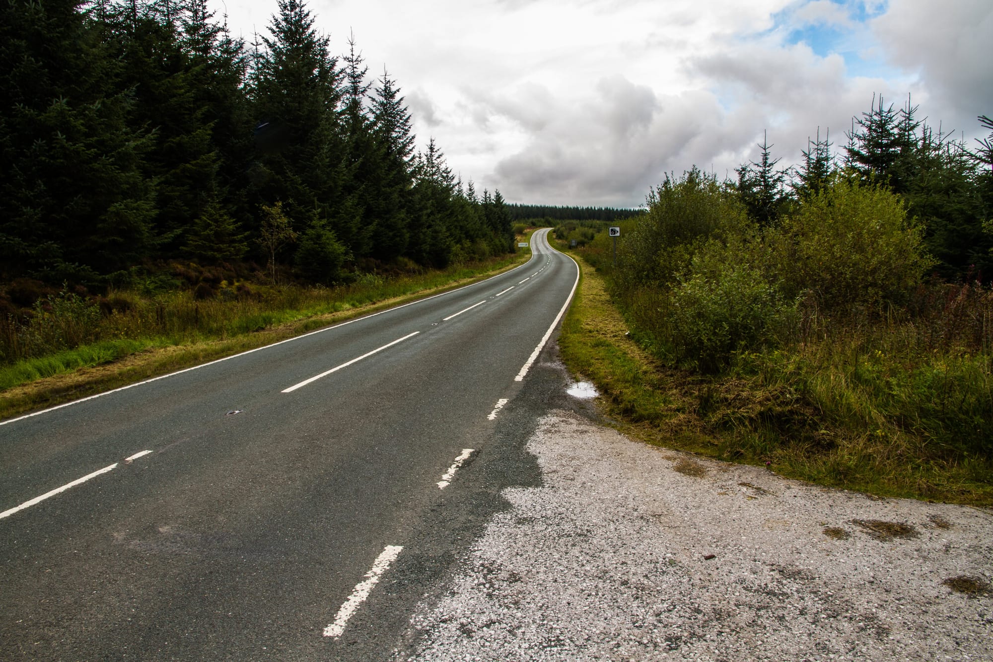
The Black Mountain Pass, also known by the slightly less glamorous name, the A4069, is located in the Brecon Beacons National Park in South Wales. It runs through the Black Mountain range, and offers stunning views of the surrounding countryside and is full of tight twists and turns. Once again, Clarkson put the road on the map when he used it to test the Mercedes CLK Black Series in the mid 2000’s. A 40mph speed limit has been introduced in recent years, but there are plenty of surrounding roads with a national speed limit, such as the A4067, which is a valley over to the East.
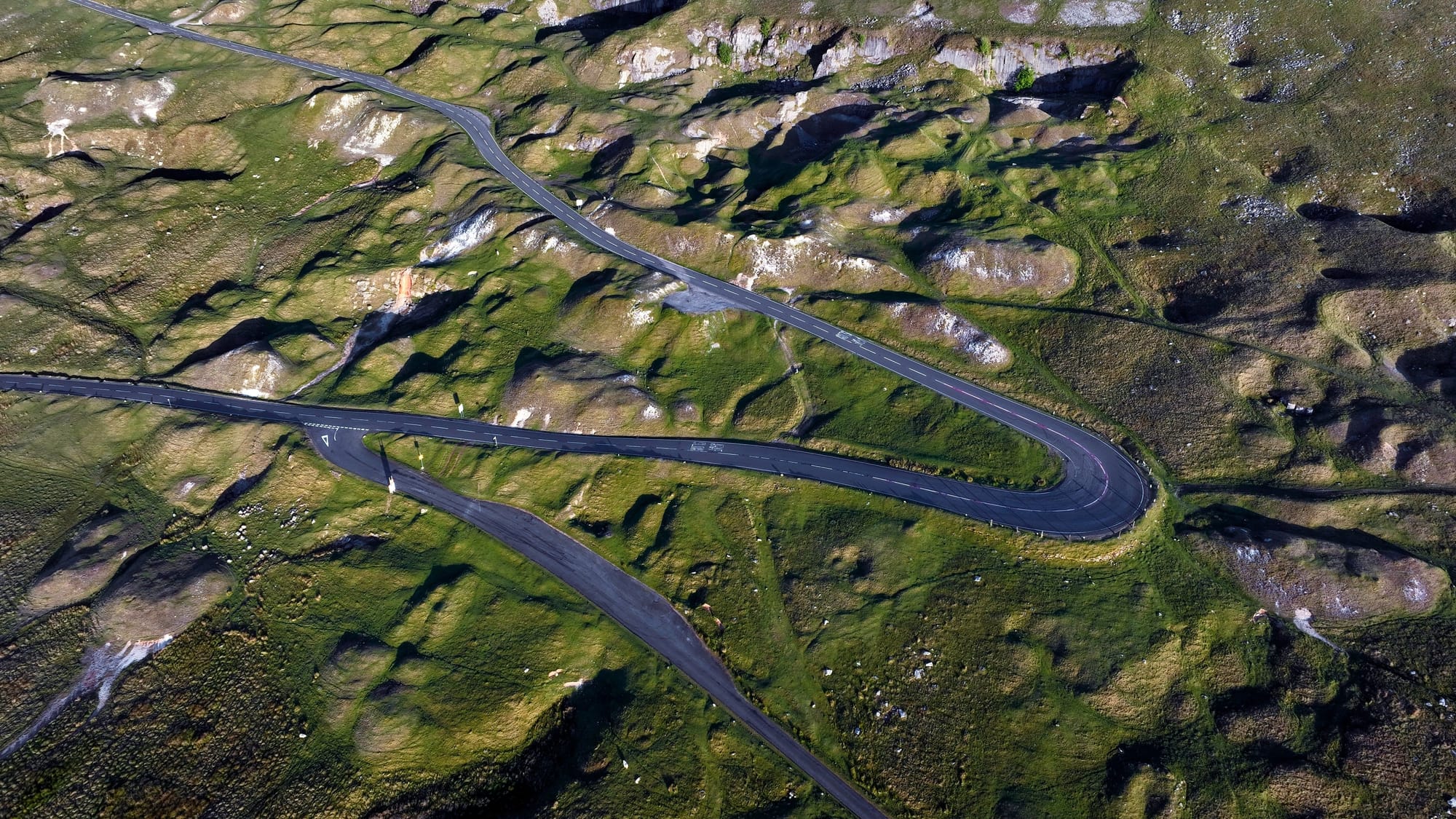
The journey commences at the junction with the A474 to the north of Gwaun-Cae-Gurwen, proceeding through Lower Brynamman and Brynamman. Continuing onwards, the road traverses the majestic Black Mountain range, before emerging near Felindre, close to Llangadog. From there, it winds its way through Llangadog and proceeds northeast until intersecting with the A40 at Llandovery. Along its course, the road ascends to a peak elevation of 493 metres above sea level.
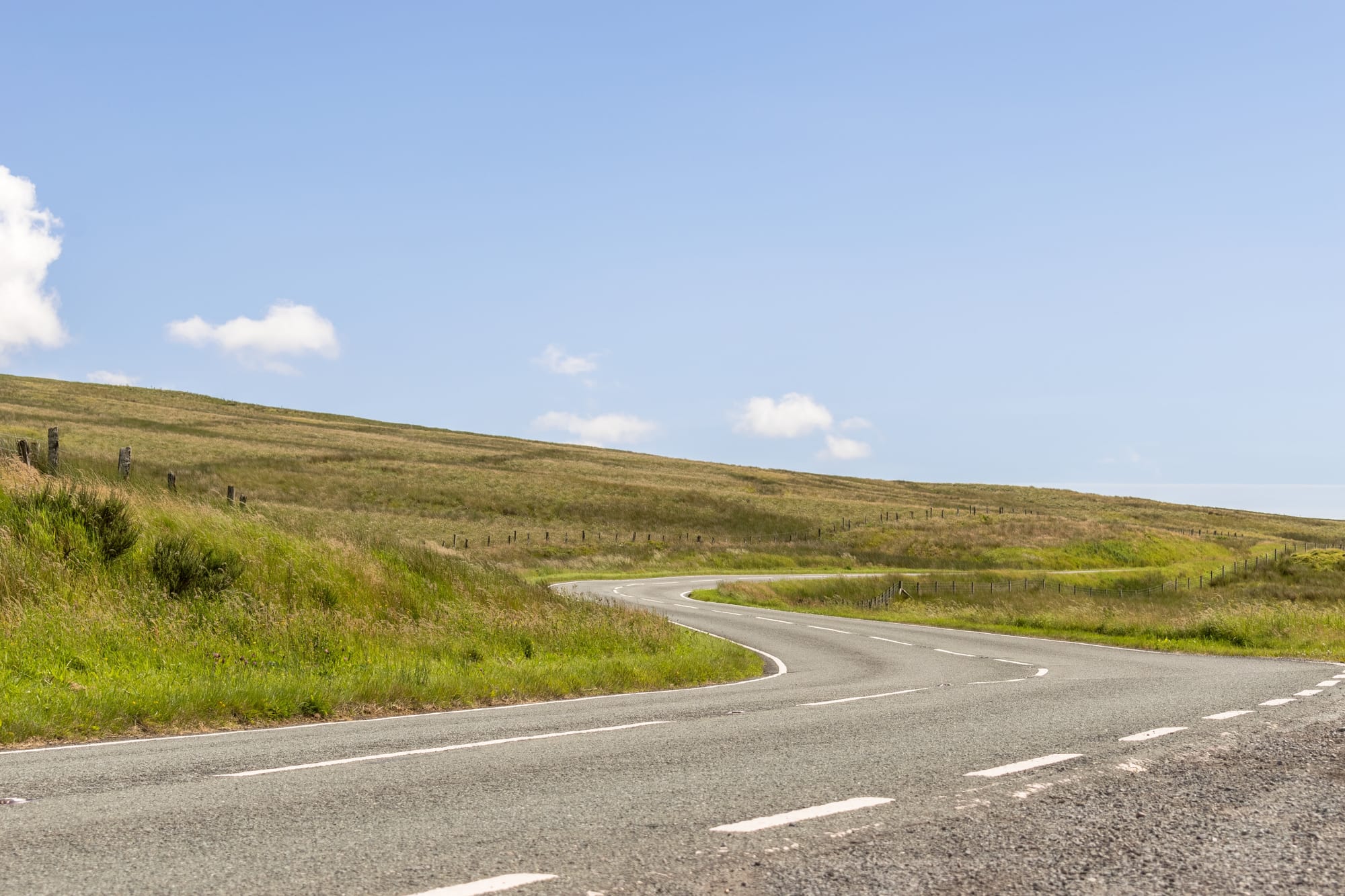
Evo Triangle, North Wales
The Black Mountain Pass isn’t the only road in Wales that tops the charts of the UK’s best driving roads. A 3 hour drive north from the Black Mountain Pass lies the Evo triangle, a route regularly used by Evo to test a car's performance and handling. Comprising three roads - the A5, the A543 and the B4501 - this triangular section of road weaves through the landscape with a blend of swift stretches and daring curves.
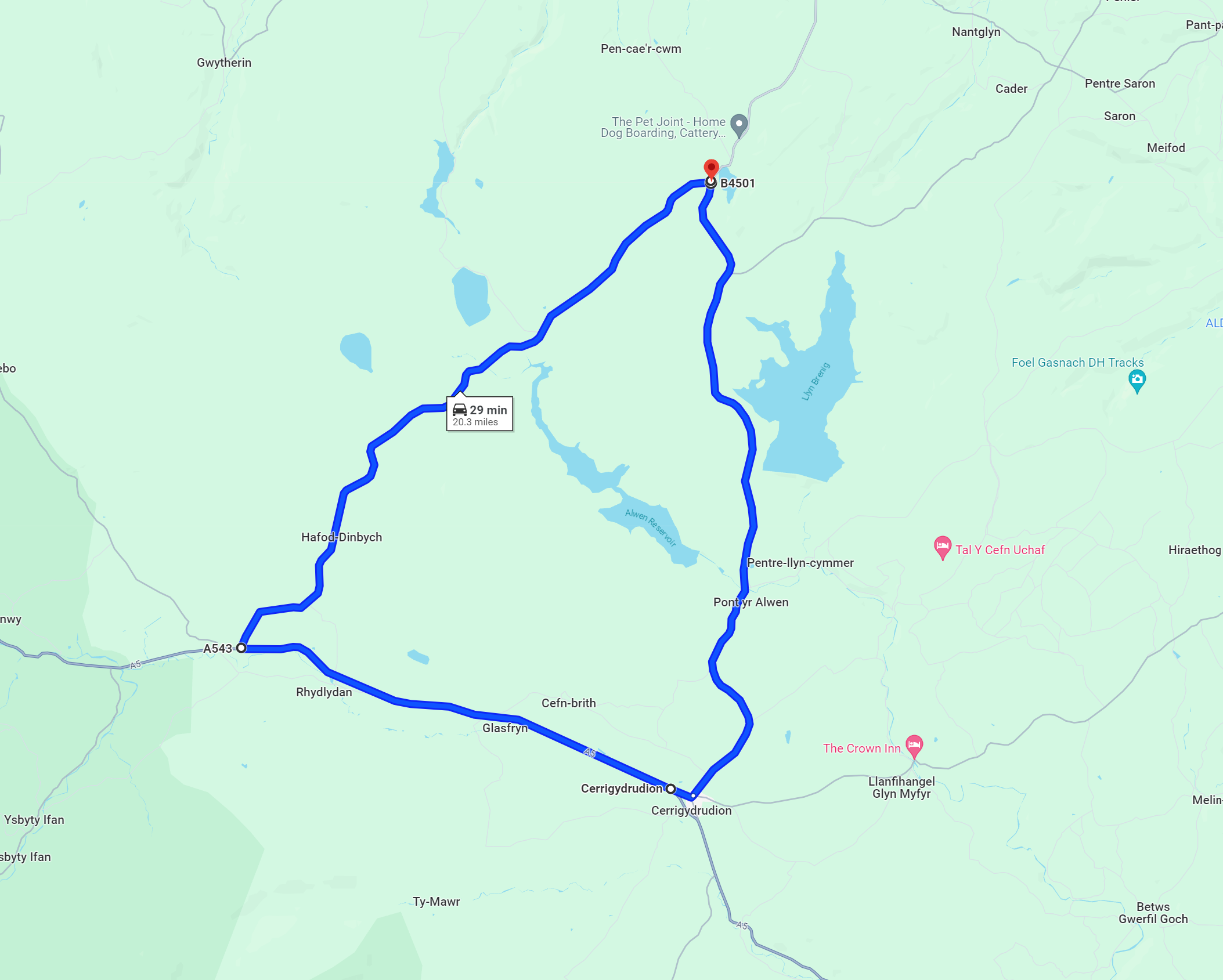
The B4501 offers glimpses of the serene beauty of Llyn Brenig Lake, and as you near the end of the route, the road meanders back to the A5, passing through the quaint village of Cerrigydrudion, eventually leading full circle to the starting point. It’s about 20 miles long, and its triangular layout invites at least a couple of laps.
Sam from SeenThroughGlass takes his Jaguar F-Type to the Evo Triangle
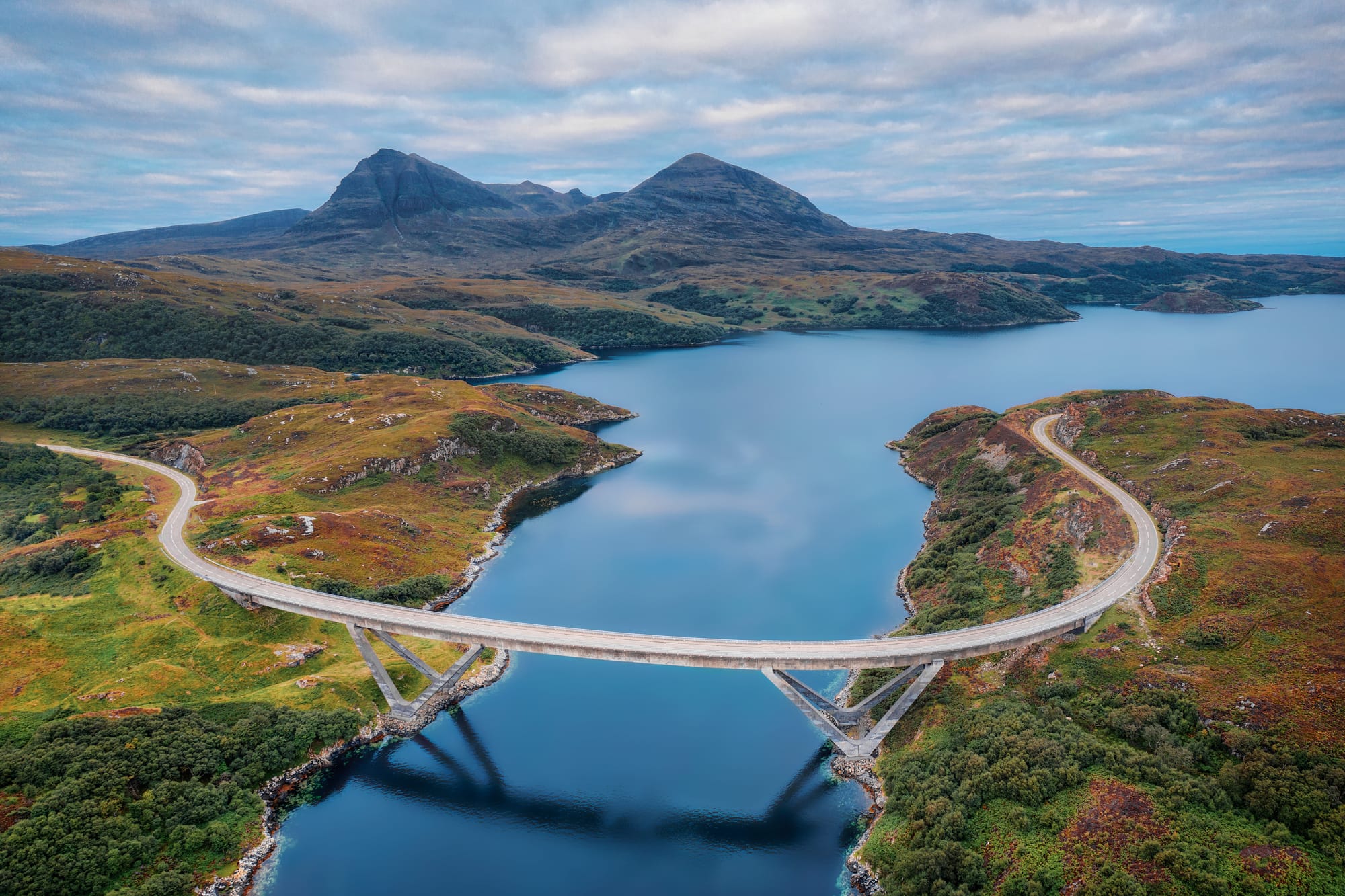
NC500, Scotland
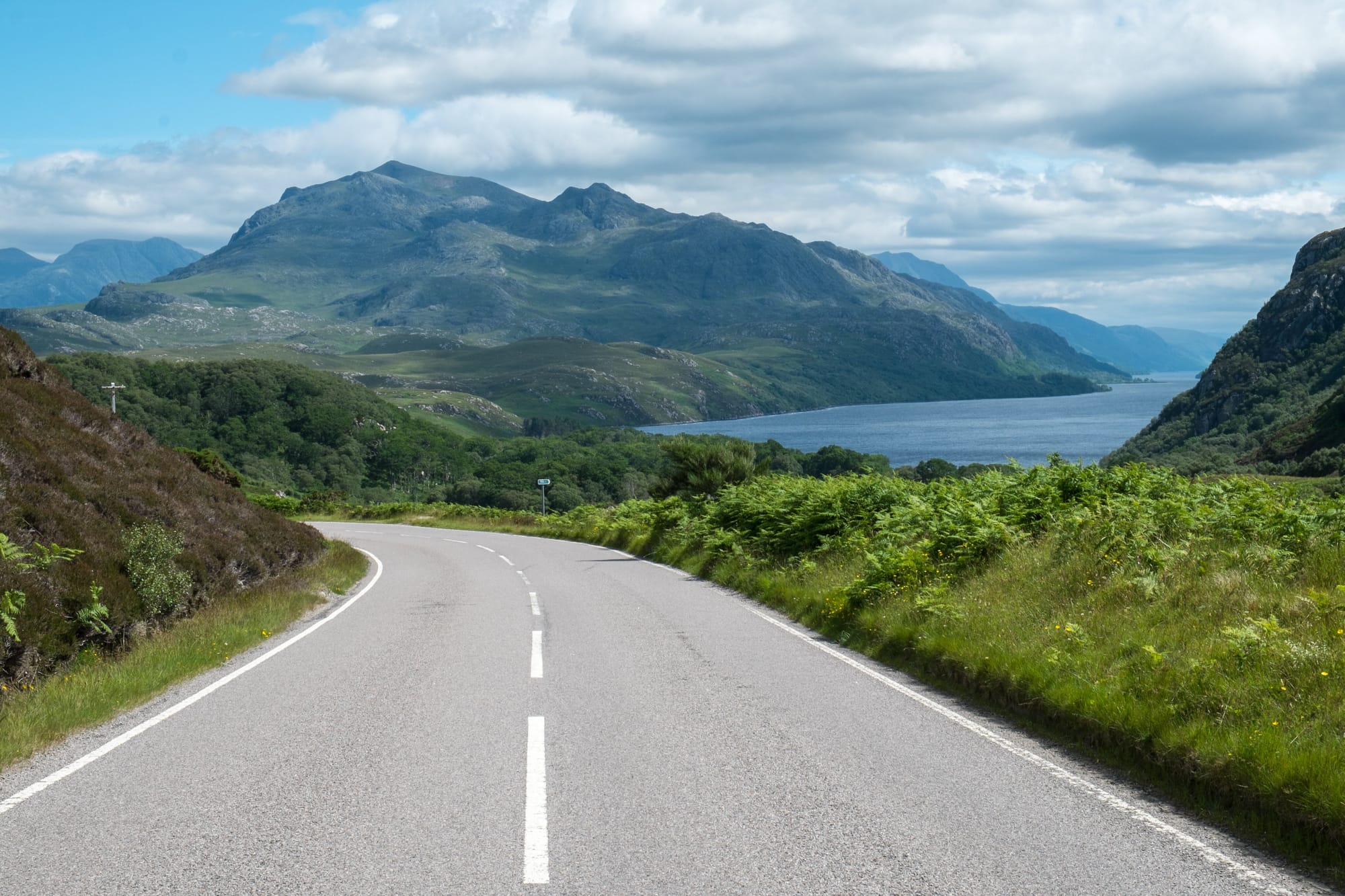

The UK roadtrip on every petrolheads bucket list has to be the NC500. Starting and finishing in Inverness, this 516 mile route takes you up and around the North coast of Scotland. One of the highlights is the Bealach na Bà, a mountain pass notorious for its steep gradients and hairpin bends. Climbing to a height of over 2,000 feet, this narrow road provides breathtaking panoramic views of the surrounding mountains and sea lochs. You’ll also get the chance to drive over the iconic Kylesku Bridge which carries the A894 across Loch a' Chàirn Bhàin between Lochinver and Durness.
The route attracts a lot of tourists and even has its own website (here), so time your trip wisely. While you’re there it makes sense to check out the Glen Etive road (the one they used in Skyfall) near Glencoe, which is south of Fort William and can be reached along the A82 between Glencoe and Bridgy of Orchy. The truth is, the Scottish highlands is full of great roads, so full explorer mode is encouraged. Just plan accordingly and be respectful of locals and the beautiful countryside (*this of course applies to all locations featured).
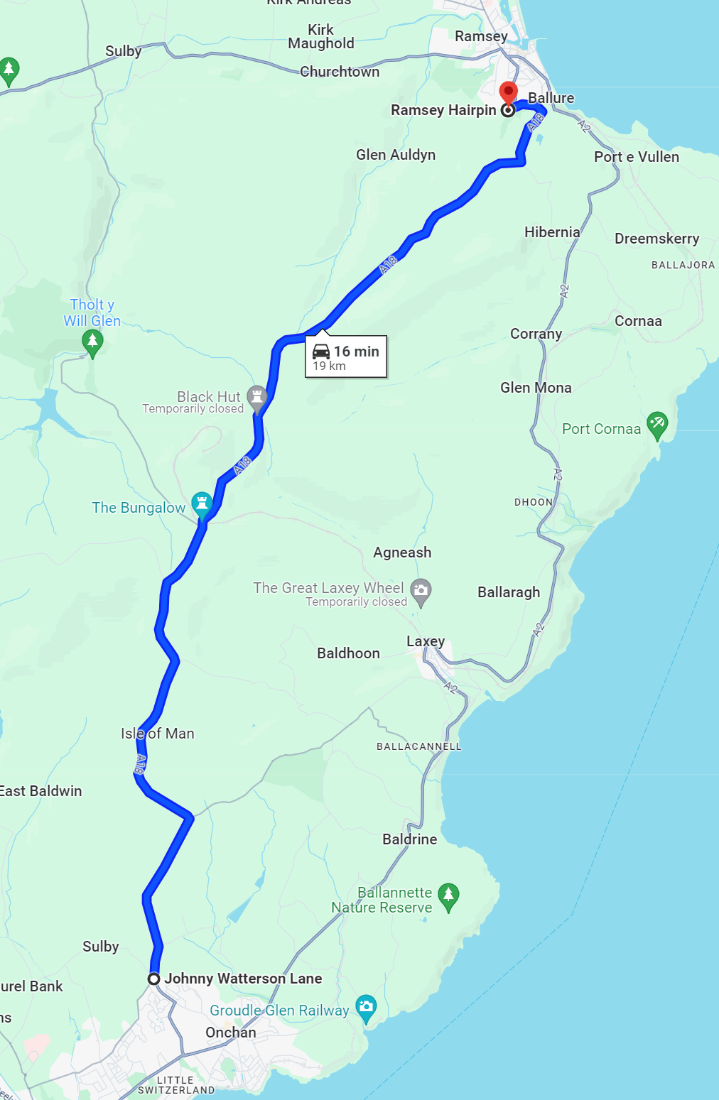
Snaefell Mountain Road, Isle of Man
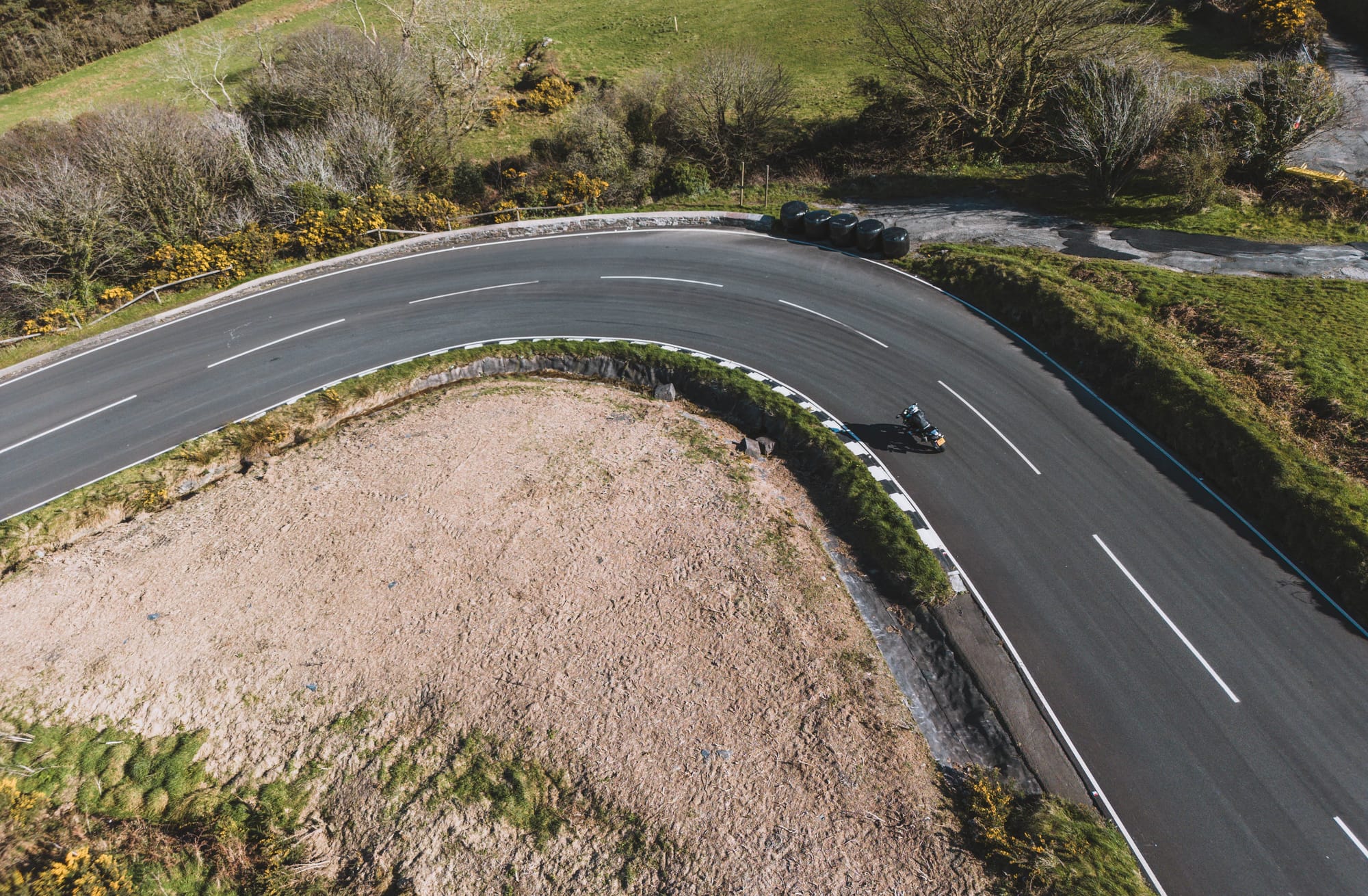
The Snaefell Mountain Road is a legendary stretch of tarmac located on the Isle of Man, and is famous for hosting the annual Isle of Man TT race. This 13 mile road winds its way up to the summit of Snaefell, the highest peak on the island, standing at 620 meters (2,034 feet) above sea level, and has a 14% gradient in places and tight hairpins. But the real allure comes from the opportunity to follow in the tyre tracks of some of the world's greatest racers.
As well as being one of the best driving roads it’s also one of the most dangerous, with little room for error, steep drops, and risk of landslides. Combined with the fact that the Isle of Man is one of the few British territories with no national speed limit, extra care and attention is required.
Cheddar Gorge, Somerset
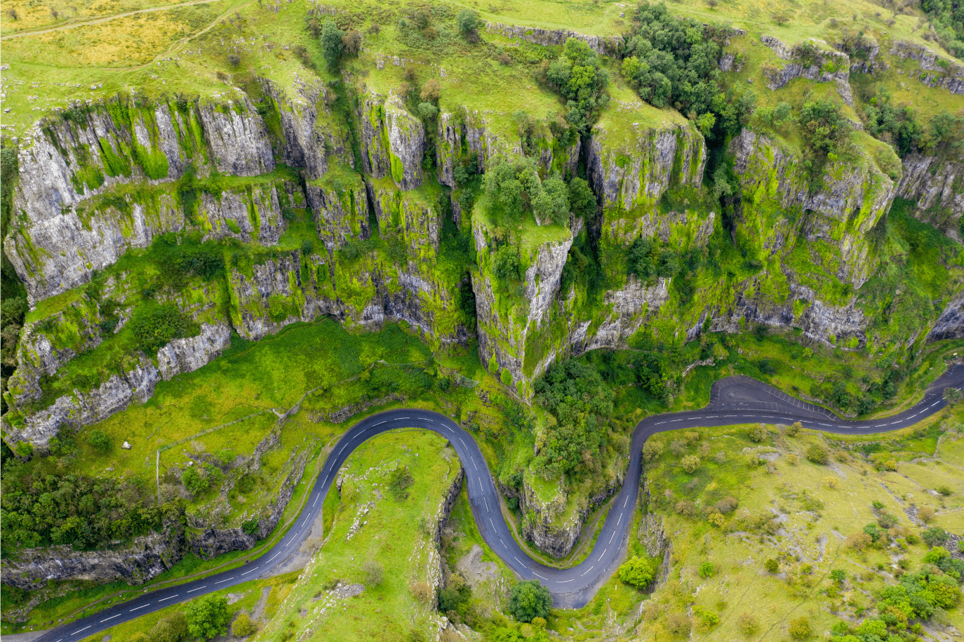

Carved over thousands of years by the Cheddar Yeo River, Cheddar Gorge is one of the best places to go for a drive in the South of England. You’re nestled between limestone cliffs that are up to 453 ft tall, making it the deepest natural canyon in England. The road itself is the B3135 and it’s about 10 miles long. Given how narrow the road can get, agility is key.
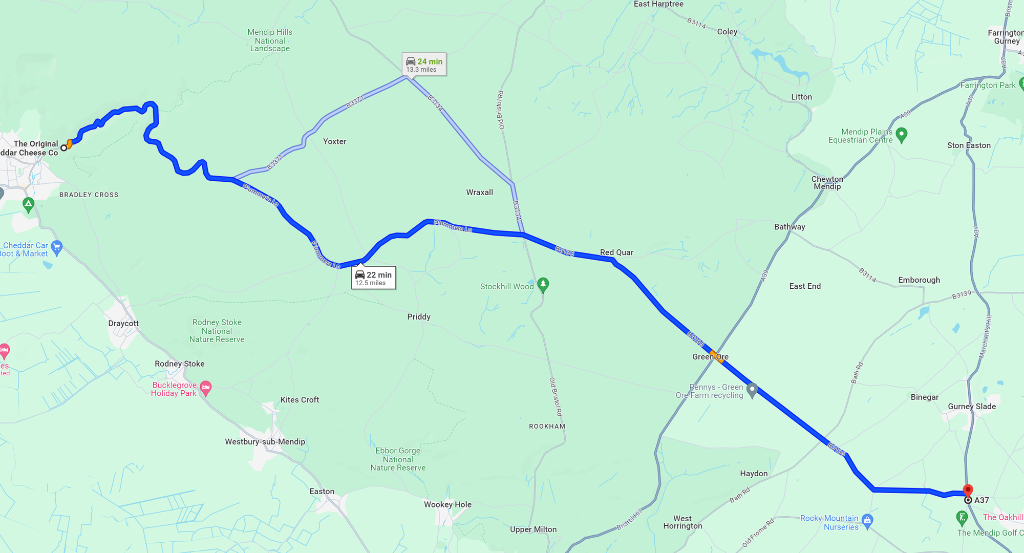
There’s also a great deal of historic significance associated with the area. Gough’s cave which is located on the outskirts of Cheddar (the end of the B3135 if you’re approaching from the East), is where archaeologists discovered the earliest human remains in Britain which date back 10,000 years. The cave is a popular tourist attraction, so there’s plenty you can do in the surrounding area to complement the great driving roads.
Jump to 7:15 if you want to see more of Cheddar Gorge